Customer Enumeration & Asset Mapping
- Customer Enumeration & Assets Mapping for Power (Discos)
- Customer Enumeration & Assets Mapping for Telecoms
- Customer address Verification for Banks (KYC)
Customer Enumeration & Asset Mapping

Progis Geospatial Limited has extensive experience and capacity in carrying out scientific customer (service recipient) enumeration and assets mapping, ranging from identification of service receivers locations, mapping of built-up properties, auditing or registration of assets, geospatial database infrastructure development, design and deployment of bespoke Intelligent Applications Programming interface for data exchange and integration of geospatial data, with business data for informed decision making.
Our expertise includes Provision of updated, accurate and georeferenced geospatial dataset which can be used for several applications in the power, telecom, financial and other sectors of the economy. Field data collection is aided with our proprietary tool known as the Progis Data Collector (PDC).
Mapping And Planning Of Electricity Distribution Network
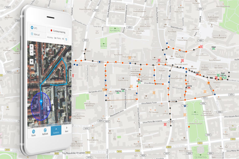
The electricity distribution system is one of the main parts of electric power systems. It’s important to transform existing systems and utilize the latest technologies to overcome issues such as power theft or poor distribution of power supply. Learn how the new line collecting feature in GIS Cloud can be of help in electricity distribution network management.
Electric utility companies need to have two types of geographical information: a distribution network containing crucial technical information and locations of numerous poles, power lines, circuits, transformators, facilities etc., and consumer and billing information with a list of existing customers, their locations and consumption details to determine the areas for a potential customer and network expansion.
Fighting Electricity Theft In Nigeria With GIS Technology
Electric utility companies across Nigeria struggle with electricity theft. The illegal connections to the power grid generate huge losses and are a hazard for locals. GIS technology can help mitigate the problem by enabling real-time insights and proper electric network visualization.
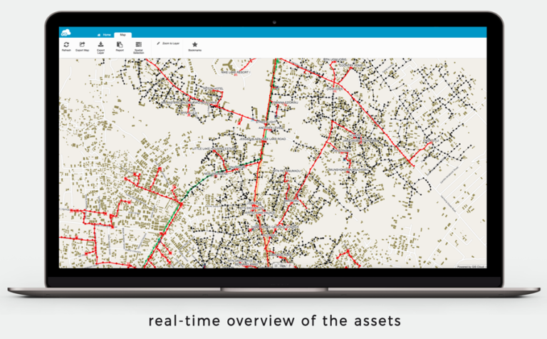
GIS technology is widely used in the field of electric utilities for a range of purposes, from electricity network visualization and real-time insight into the status of the assets to risk management and the efficient resolution of customers’ problems and requests.
Knowing that the electricity distribution system comprises of kilometers of power lines connecting the end users to the substation, it is very important to have the network properly visualized.
This can help with locating issues with connectivity or power outages, as well as with optimizing the usage of resources and identifying sources of energy loss. Customer indexing or enumeration, on the other hand, enables better customer service related to this issue and helps with monitoring consumption in the particular area.
This use case demonstrates the benefits of GIS Cloud for mapping both electricity network assets and customers (customer enumeration) in real time.
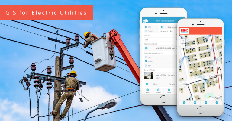
GIS For Electric Utilities
Asset Inventory And Infrastructure Insights
It’s crucial to have an accurate asset inventory with electric poles, transformers, cable lines, substations and other electric utility assets properly mapped. GIS allows you to manage the asset data a lot easier and enables you to take insight from the infrastructure.
Optimizing Field Operations
Field operations in electric utilities are usually about mapping the infrastructure and performing routine inspections. But to get high-quality field data, you need an effective field workflow and a field crew equipped with surveying equipment or data collection apps.
Collaborating And Sharing Geospatial Data
To get the most out of GIS technology, it’s best to connect everyone in the workflow: field workers, engineers, managers, decision makers and clients. The web-based GIS apps allow you to keep your data centralized in one place enabling, everyone to collaborate over the same geospatial dataset.


